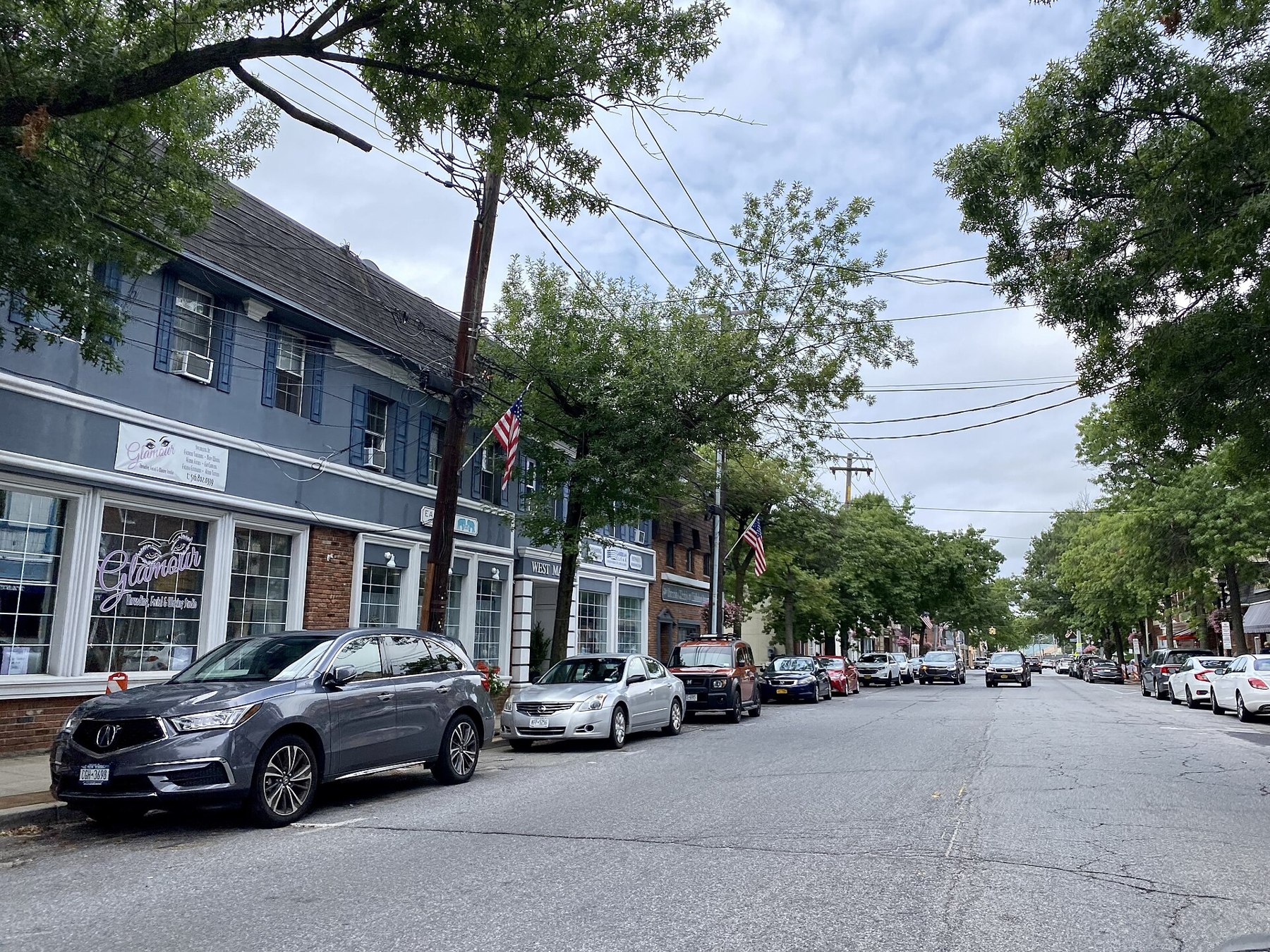
Oyster Bay source photograph

Outdoors

Biking and mountain biking near Oyster Bay

Trails and recreation areas near Oyster Bay open to biking and mountain biking.

12places to ride
9 mito the closest
5within 30 miles
March–Novemberbest months

Good to know: Wilderness areas are closed to bikes; check each area’s trail rules and yield to hikers and horses.

Closest picks

1

Sagamore Hill National Historic Site

9 mi north · National Park Service

Sagamore Hill was the home of Theodore Roosevelt, 26th President of the United States, from 1885 until his death in 1919. During Roosevelt's time in office, his "Summer White House" was the focus of international attention.

2

Camp Gateway- Brooklyn Ny

23 mi southwest · National Park Service

There's no other campground in the world where a family can sleep under the stars, tour the Statue of Liberty, watch a Broadway musical and kayak in one of the world's premier bird migration sanctuaries-all in one trip.

3

Gateway National Recreation Area

26 mi southwest · National Park Service

Spanning 27,000 acres from Sandy Hook in New Jersey to Breezy Point in New York City, the park is both the gateway from the ocean into New York Harbor, and the gateway to the National Park Service for millions of visitors every year.

Map of all 12 places

Map of 12 places loads as you scroll.

Within 30 miles (5)

9 mi north · National Park Service

Sagamore Hill National Historic Site

Sagamore Hill was the home of Theodore Roosevelt, 26th President of the United States, from 1885 until his death in 1919. During Roosevelt's time in office, his "Summer White House" was the focus of international attention.

  • Biking
  • Hiking
  • History
  • Picnicking
  • Wildlife viewing

23 mi southwest · National Park Service · Campground

Camp Gateway- Brooklyn Ny

There's no other campground in the world where a family can sleep under the stars, tour the Statue of Liberty, watch a Broadway musical and kayak in one of the world's premier bird migration sanctuaries-all in one trip.

  • Archery
  • Biking
  • Camping
  • Fishing
  • Hiking
  • Horseback riding
  • Ranger programs
  • Star Gazing

26 mi southwest · National Park Service

Gateway National Recreation Area

Spanning 27,000 acres from Sandy Hook in New Jersey to Breezy Point in New York City, the park is both the gateway from the ocean into New York Harbor, and the gateway to the National Park Service for millions of visitors every year.

  • Biking
  • Boating
  • Camping
  • Fishing
  • Paddling
  • Swimming

28 mi west · National Park Service

Governors Island National Monument

From 1794 to 1966, the U.S. Army presence on Governors Island played a vital role in the social, political, and economic life of New York City. The island then served as the headquarters of the U.S.

  • Biking
  • Picnicking

30 mi west · National Park Service

National Parks of New York Harbor

These 12 sites preserve more than 400 years of American history! We invite you to explore the past and investigate its relevance in our lives today.

  • Biking
  • Boating
  • Camping
  • Fishing
  • Hiking
  • History
  • Paddling
  • Picnicking

30 to 75 miles (4)

31 mi west · National Park Service · Campground

Camp Gateway - Staten Island

This campground boasts a spectacular view of the Verrazzano-Narrows Bridge, the longest vehicle suspension span in the United States. When it opened in 1964, it was the longest span in the world for 17 years.

  • Biking
  • Birding
  • Boating
  • Camping
  • Evening Programs
  • Fishing
  • Guided Interpretive Walks
  • Hiking

34 mi southwest · National Park Service · Campground

Camp Gateway - Sandy Hook

Welcome to Gateway National Recreation Area, Sandy Hook Unit! There are a variety of cultural and recreational opportunities available at the park including history tours, living history demonstrations, hiking, birding, kayaking, camping,…

  • Biking
  • Birding
  • Boating
  • Camping
  • Canoeing
  • Cultural Activities
  • Evening Programs
  • Fishing

57 mi northeast · US Army Corps of Engineers · Campground

Hop Brook Lake Recreation Area

Hop Brook Lake Recreation Area is located within the towns of Middlebury, Naugatuck and Waterbury, Connecticut. Its 536 acres provide excellent recreation opportunities and a chance to escape from the growing suburbia surrounding the park.

  • Biking
  • Boating
  • Camping
  • Canoeing
  • Cross Country Skiing
  • Fishing
  • Hiking
  • Kayaking

68 mi north · US Army Corps of Engineers · Campground

Northfield Brook Lake Group Shelters

Northfield Brook Lake Group Shelters are located along a small scenic lake in the Naugatuck Valley of west-central Connecticut.

  • Biking
  • Birding
  • Camping
  • Canoeing
  • Fishing
  • Hiking
  • History
  • Kayaking

75 miles and farther (3)

115 mi north · US Army Corps of Engineers · Campground

Indian Hollow

With abundant wildlife, lush scenery and waterfront views, Indian Hollow Group Campground, located at the Knightville Dam and Reservoir, offers groups and clubs a recreational oasis.

  • Birding
  • Camping
  • Fishing
  • Hiking
  • Horseback riding
  • Hunting
  • Mountain Biking
  • Star Gazing

117 mi northeast · US Army Corps of Engineers · Campground

Westville Recreation Area

Westville Lake is situated on the Quinebaug River in the towns of Southbridge and Sturbridge, Massachusetts.

  • Biking
  • Boating
  • Camping
  • Hiking
  • Winter sports

125 mi northeast · US Army Corps of Engineers · Campground

Buffumville Lake (Group Shelter)

In 1958 the U.S. Army Corps of Engineers built Buffumville Dam in Charlton, Massachusetts to provide flood risk management for downstream communities.

  • Birding
  • Boating
  • Camping
  • Disc Golf
  • Fishing
  • Guided Interpretive Walks
  • Hiking
  • Hunting

Distances are straight-line miles from downtown Oyster Bay. Listings come from Recreation.gov’s federal recreation database; check each official page for hours, fees, fire restrictions and closures before you go.

Get outside around Oyster Bay

Birdwatching in Oyster Bay Long Island NY video thumbnail

THINGS TO DO · YOUTUBE SHORT

Birdwatching in Oyster Bay Long Island NY

A local activity Short shared by Kibachan.

Watch on YouTube ↗
Oyster Bay Oyster Festival and Cold Spring Harbor in the Fall on Long Island video thumbnail

THINGS TO DO · YOUTUBE SHORT

Oyster Bay Oyster Festival and Cold Spring Harbor in the Fall on Long Island

A local activity Short shared by Paul Balzano.

Watch on YouTube ↗

Around Oyster Bay

Massapequa Stream gauge, Oyster Bay
Massapequa Stream gaugeJim.henderson · CC BY 4.0
North Massapequa Lake 2021a, Oyster Bay
North Massapequa Lake 2021aAntony-22 · CC BY-SA 4.0
Looking south from greenway, at Massapequa Reservoir on a cloudy day nearing Sunset, Oyster Bay
Massapequa ReservoirJim.henderson · CC BY 4.0

More outdoors near Oyster Bay

Questions

Where is the closest place for biking near Oyster Bay?

Sagamore Hill National Historic Site (National Park Service), about 9 miles north of Oyster Bay as the crow flies. Next are Camp Gateway- Brooklyn Ny (23 mi) and Gateway National Recreation Area (26 mi).

When is the best time for biking near Oyster Bay?

Based on Oyster Bay’s average highs, March–November. Conditions at higher elevations can be much cooler.

Who manages these places?

Federal agencies including National Park Service, US Army Corps of Engineers. Each listing links to its official page for hours, fees, closures and current conditions.

Oyster Bay AI

Your Oyster Bay local guide
Hey there!

I'm Oyster Bay AI. Ask about neighborhood food, independent shops, local history or planning a visit.

AI recommendations may be inaccurate. Verify hours and prices. Questions are processed by Cloudflare. Privacy